Geology of the East-Sullivan Mine, Val d'Or Formation, Abitibi Subprovince, Québec
Sébastien Lavoie, Masters Thesis
 Masters thesis under the supervision of Dr. Wulf U. Mueller.
Project description
The Val d'Or Formation (2704 +/-2 Ma), composed of a tholeiitic to calc-alkaline volcano-sedimentary assemblage, forms part of the Southern Volcanic Zone of the Abitibi Subprovince. It hosts several volcanogenic massive sulphide deposits, including the East-Sullivan ore deposit (16.8 Mt @ 1.023% Cu, 0.695% Zn and 0.329 g/t Au). This ore deposit is the topic of a Master's project conducted at UQAC with the support of the MRNQ, within the framework of the Val-d'Or Formation mapping project.
The stratigraphic sequence that hosts the deposit forms a south-facing homoclinal assemblage, apparently distinct from the sequence hosting the Louvicourt deposit. The East-Sullivan sequence is composed, in stratigraphic order, of mafic to intermediate volcaniclastic material (>1 km), intermediate to felsic massive flows (500 m), intermediate pillowed flows (25 m) and fine felsic tuffs (75 m). The fine tuffs are overlain by a unit of massive intermediate lavas that cap the system. The East-Sullivan monzonitic pluton (ESP) (2684 +/-1 Ma) cross-cuts the mineralization to the east, whereas a series of porphyry diorite dykes truncate the ore deposit to the south. According to available information, the mineralization consisted of a stockwork related to the fracturation and the replacement of the tuffaceous unit. The ore was distributed in twenty or so lenses with slightly different compositions, thus outlining a zinc zonation in the deposit. Zinc lenses, concentrated at the stratigraphic base (north) of the deposit, appear to be unconformable relative to lithological units whereas the copper-zinc lenses seem to be subconformable to the felsic units. The ore deposit is cross-cut by two sets of faults, respectively dipping southeast and southwest.
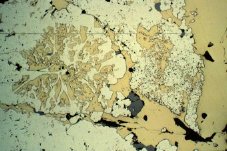
The hydrothermal alteration zone surrounding the deposit is characterized by sericite and chlorite. An amphibolite-grade metamorphic aureole and a strong epidote alteration affect country rocks over a distance of 500 m from the ESP. The absence of an alkali-leached zone in the vicinity of the mine suggests that the alteration pipe is either located at depth, or has been destroyed by the emplacement of this pluton.
Surface mapping has outlined an assemblage of fine tuffs, lapilli tuffs with vesicular fragments and massive lobes of rhyolite. This assemblage seems to form the lateral extension of the deposit. Felsic lobes occur above a thin horizon of intermediate pillow breccia aligned with the base of the ore deposit. These horizons can be traced over a distance exceeding one kilometre to the west of the mine. However, the distal portion of the reworked felsic tuffs is progressively replaced by mudstone beds. A compilation of mine data indicates the presence of a topographic high or rhyolitic dome, where the mineralization seems to be concentrated. Over 60% of the mined ore would have accumulated in a depression that was mainly filled by volcaniclastic material and that was located on the flank of this small volcanic construction.
Question or commentary contact me: geologue@yahoo.com.
